"Chicago" by Carl Sandburg

Hog Butcher for the World,
Tool Maker, Stacker of Wheat,
Player with Railroads and the Nation's Freight Handler;
Stormy, husky, brawling,
City of the Big Shoulders

-excerpt from the poem "Chicago" by Carl Sandburg (1916)

Chicago Skyline

Chicago Skyline
The Chicago Skyline from a Near West Side highrise

Tuesday, December 27, 2011

Irving Park

The Breakdown
Classy homes along Irving Park Road
An overview: Irving Park means more as a street to many Chicagoans than as a neighborhood.  Those unfamiliar with the neighborhood probably don’t realize that it’s safe, historic, and diverse.  They also don’t realize that it offers restaurants, bars, and music venues that rival those in any other Chicago neighborhood.  What this quiet part of the Second City lacks in quantity, it makes up for in quality.

Irving Park can technically be broken up into a few smaller neighborhoods.  The western half is often referred to as “Old Irving Park”.  Sometimes Mayfair and Kilbourn Park are considered parts of the Irving Park community area as well.  There is a tiny historic section called “The Villa”, a triangle of hundred-year old homesteads.  An explanation of The Villa is shown below.

The boundaries: The boundaries of the Irving Park community area are somewhat erratic, so it’s probably best to refer to the map at the bottom of the page.  Generally though, they are Montrose to the north, Addison to the south, the Chicago River to the east, and the Milwaukee District-North railroad tracks to the west.  As you head further west in the community area, the northern boundary becomes Lawrence and the southern boundary becomes Belmont.

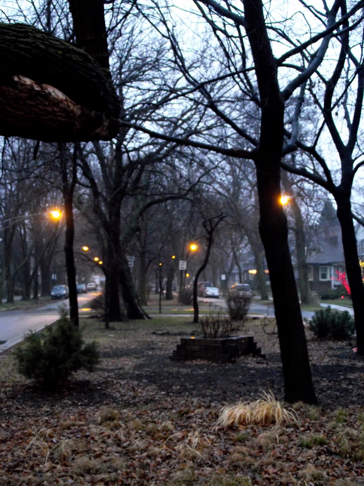
Tree-covered public space divides several of the
boulevards that run through the Villa District
Population make-up: The Irving Park community area has seen a gradual decrease in population since 2000.  Between the 2000 census and the 2010 census, only one of Irving Park's fifteen census tracts actually grew in population, and even that (the area around Kilbourn Park) only grew by 0.3%.

The 2010 population of the Irving Park community area was 53,359, a decrease of 9% from its 2010 census count of 58,643.  The racial breakdown of the neighborhood is 45.8% Hispanic, 41.7% white, 6.9% Asian, and 3.2% black.

A brief history: The Irving Park area was originally intended to be a farming settlement.  However, realizing the value of the land due its proximity to downtown Chicago, Charles T. Race decided it was an opportunity better suited for residential development.  Originally an upscale suburb of Chicago, it was annexed into the City in 1889.  The community area reached a population of over 65,000 in the 1930, sparked by immigration, particularly from Eastern Europeans in the preceding decade.  Over the years, Irving Park has become most well known for its historic residential area, the Villa District, a small residential triangle of land still predominantly featuring bungalows nearly one hundred years old.  The Villa’s borders are essentially Pulaski Road to the west, Addison Street to the south, and the Kennedy Expressway (I-90/94) to the northeast.

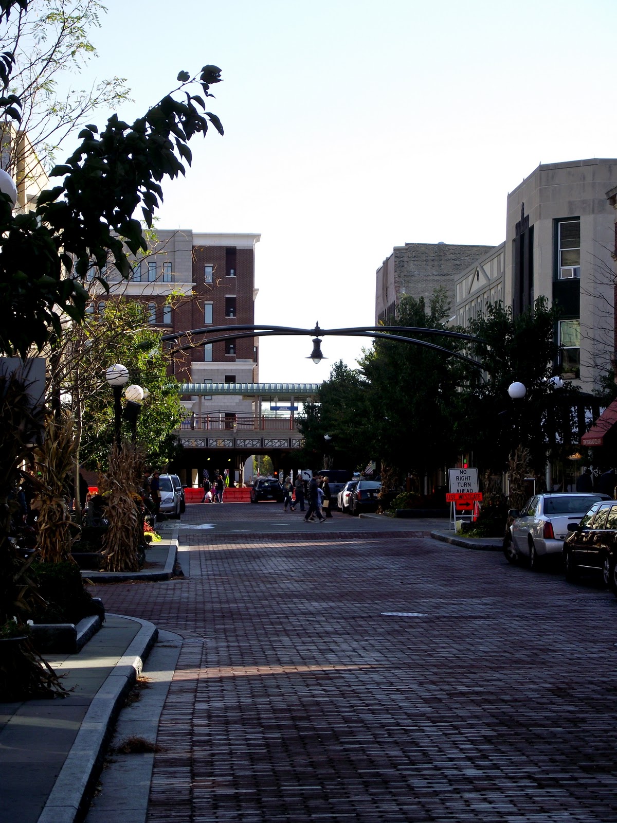
Commerce mixing with residential at Kimball & Elston
Today Irving Park is often known as a safe, sleepy, middle-class residential neighborhood.  However, it offers a surprising amount of amenities in terms of dining and nightlife, notably Arun’s, a Chicago institution since the mid-80s and still considered one of the nation’s very best Thai restaurants.  Recent decades have seen an influx of Hispanics into the neighborhood, as well as in bordering Albany Park and Avondale.

Getting there: The “L” is a more-than-serviceable option.  The Blue Line has three stops in the neighborhood: Montrose, Irving Park, and Addison.

If travelling by bus, your best east-west bets are: Montrose (78), Irving Park (80), and Addison (152).  You can also take Lawrence (81) to the far northwest corner and Belmont (77) to the far southwest corner of the neighborhood.  Going north-south you can take Pulaski (53), Kimball (82), and California (52).  Also, the Milwaukee bus (56) goes through a northwest-southeast sliver of the neighborhood.

Saturday, December 10, 2011

North Center/St. Ben's

The Breakdown
Beautiful autumn day in North Center
An overview: North Center.  It’s like Lake View without the drama…well, and the lake.  In all seriousness though, North Center is that neighborhood every North-Sider has been to often without realizing what neighborhood they’re in.  What’s here is a bevy of restaurants and taverns located within one of the City’s safest, most pleasant areas.

The North Center community area encompasses four neighborhoods.  We’ve already covered the southern half, which is Roscoe Village and Hamlin Park.  You can read about our experience here.  This entry will cover the northern half, which covers the eponymous North Center neighborhood, and the smaller St. Ben’s.

It's not quite Trajan's Column but it'll do


The boundaries: The boundaries of the North Center (sometimes spelled "Northcenter") neighborhood are Montrose Avenue to the north, Addison Street to the south, Ravenswood Avenue to the east, and the Chicago River to the west.  The St. Ben’s is a mostly residential neighborhood encompassed within the larger North Center neighborhood.  Named after St. Benedict’s Catholic Church (2215 W. Irving Park Road), its borders are Irving Park Road to the north, Addison Street to the south, Damen Avenue to the east, and Western Avenue to the west.


Population make-up: Between 2000 and 2010, the population of the North Center community area basically stayed the same, losing only 28 residents over that 10-year period.  The 2010 population count for the entire community is 31,867.

The population of the North Center/St. Ben’s neighborhood itself has increased since 2000, now at approximately 16,317, a 1.5% increase over the past decade.  The racial breakdown of the neighborhood is 78.6% white, 12.5% Hispanic, 5.3% Asian, and 1.7% black.


St. Benedict Parish (background)
is one of North Center's icons
A brief history: North Center really began to grow just after the Chicago Fire in 1871.  Demand for brick housing was supplied in the area, giving the neighborhood the nickname “Bricktown”.  Meanwhile, immigrants flooded into the area to work in the industrial plants along Ravenswood Avenue, notably Germans whose imprint is still left today in many of the restaurants and taverns along the neighborhood’s major corridors.  North Center was also home to a very famous amusement park, Riverview, which was open from 1904-1967.

From the 1940s through the 1990s, the neighborhood saw a drop in population, which has stabilized in the past couple decades thanks in part to an influx of Asians and Hispanics.  Today it is a pleasant mix of young professionals and families living in single-family homes and brick two-flats.  Eclectic shops, diverse restaurants, and trendy bars make North Center enticing to those who are looking for an accessible neighborhood filled with amenities without the density found in the Lake Michigan-bordered neighborhoods.


Getting there: By “L” you have three options, all via the Brown Line: Montrose, Irving Park, and Addison.  All three will leave you on the eastern portion of North Center, but the neighborhood isn’t so wide that you can’t transfer to a bus and get where you need to be in about 10-15 minutes.  Sorry bout the double-negative there.

By bus, going north-south: Western (49) and Damen (50).  Going northwest-southeast: Lincoln (11).  If going east-west: Montrose (78), Irving Park (80), and Addison (152).

Wednesday, November 9, 2011

Chicago Marathon 2011 - 26.2 Miles Through Chicago’s Neighborhoods

The sun also rises over Michigan Avenue
On October 9, nearly 45,000 participants ran in the 34th annual Chicago Marathon.  Along with the races in New York, Boston, Berlin, and London, Chicago's is considered one of the "World Marathon Majors".  Unlike the Boston Marathon (in which only about two miles actually take place WITHIN Boston’s city limits), the entire Chicago Marathon is a journey through some of the city’s most notable neighborhoods.

This year, one of those 45,000 was Laura, your fair blogger for this site.  Meanwhile, Michael actively participated…as moral support from the sidelines.  While Laura was focused on completing her first marathon, Michael ran around several of the neighborhoods to catch the action.

Below is a list of each mile and which neighborhood the runners traversed.  We’ve also attached an image of the scenes where Michael caught the action.

Sunday, October 30, 2011

Oak Park

The Breakdown
The intersection of Lake & Marion in downtown Oak Park
An overview: Few towns, let alone cities, can lay claim to being home to the “greatest” of his or her profession.  Oak Park can lay claim to two unquestionable geniuses.  Frank Lloyd Wright maintained his home/studio here from 1889-1909, and Oak Park still bares the largest collection of his work in any one area.  During the time America’s premier architect resided here, Ernest Hemingway was born in 1899 only two blocks away.  Coincidence?  Probably.  But still quite the amazing coincidence.

There may not be any scientific reason that the town was home to two of our country’s greatest artists, but their genius certainly wasn’t groomed in poverty.  Oak Park was, and remains, one of the most beautiful communities you’ll come across.  Modern mansions mix almost seamlessly with hundred-year old residences of striking beauty.  The downtown continues to thrive with shops, restaurants, and a vintage movie palace.

Looking southward down Marion Street
Oak Park is the first of what will likely be several entries on individual suburbs.  While the main focus of the blog is on Chicago’s neighborhoods, it’s also a chance to reflect on communities that have thrived thanks to the Windy City’s influence.  Due to its immediate proximity, Oak Park will always be inextricably tied to Chicago.  It is absolutely worth multiple visits for architecture buffs, foodies, history lovers, or anyone who enjoys walking along lush tree-lined streets.

The boundaries: Unlike virtually every other Chicago suburb (many of which look like an ink blot), the City of Oak Park is a perfect box.  The boundaries of the city are North Avenue to the north, Roosevelt Road to the south, Austin Boulevard to the east, and Harlem Avenue to the west.

The downtown is another interesting beast.  Most downtowns are also called “central business districts” because they’re, well, centralized within the community.  Oak Park’s downtown is AS FAR WEST AS YOU CAN GO within the town.  It starts west at Harlem Avenue and runs a few blocks east to about Kenilworth Avenue.  Lake Street runs right through the heart of the downtown.  There’s a large commercial district west of Harlem Avenue that is more of a strip center and doesn’t really match the downtown feel of Oak Park.  That’s because west of Oak Park is actually River Forest north of the train tracks, and becomes Forest Park south of the tracks.  Oak Park, Forest Park, River Forest…got it?  Good.

Population make-up: The population of Oak Park dropped slightly as of the 2010 Census.  The 2010 population was 51,878 down 1.2% from 2000.  The racial make-up of Oak Park as of last year was 63.8% white, 21.2% black, 6.8% Hispanic, and 4.8% Asian.

Frank Lloyd Wright Home and Studio
A brief history: The area around Oak Park was first settled in 1835, but didn’t experience any real growth until just after the Civil War and the Great Chicago Fire that followed six years later in 1871.  It seceded from Cicero in 1902, becoming its own municipality.  It grew exponentially throughout the first half of the 20th century, and successfully embraced racial demographic change in the early 1960s.  Throughout its history, it has been home to many notable residents, not only Hemingway and Wright, but also Edgar Rice Burroughs (creator of Tarzan and author of numerous beloved novels) and Ray Kroc who turned McDonald’s from a local burger joint into a worldwide phenomenon. 

Although the population has decreased noticeably from its 1940 high of 66,000 residents, Oak Park has held its position as one of Chicagoland’s most beloved destinations.  In 2010, the Frank Lloyd Wright Historic District was named one of the APA’s (American Planning Association) “10 Great Neighborhoods”.  Despite the westward growth of the Chicago metro area, Oak Park remains one of its true gems.

Getting there: By “L”, you’ve got multiple options.  The Green Line will take you right to downtown if you get off at Harlem/Lake or the Oak Park stop.  There are also Green Line stops at Ridgeland and Austin.  The Blue Line makes stops in the southern part of town at Harlem, Oak Park, and Austin.

CTA bus isn’t likely your best option, but you can get there going east-west via North (72) and Lake (20).  Going north-south you can take Harlem (90), Ridgeland (86), and Austin (91).  There are also multiple PACE routes that will get you around Oak Park: 305, 311, 315, 318, and 320.

Friday, October 7, 2011

Lincoln Park

The Breakdown
Beautiful architecture lines Armitage Avenue
An overview: Hey, we knew it was gonna come to this.  Arguably the City’s most well-known neighborhood, and the one most synonymous with wealth, enjoys a healthy and safe reputation.  It’s a haven for nightlife, high-end dining, and top-notch entertainment.  Some of the City’s (country’s?) most beautiful architecture can be found here, especially along Armitage Avenue.  As a result, Lincoln Park is one of Chicago’s most expensive places to buy or rent.  That doesn’t mean you can’t visit.  Sure, you could drop $350 a person for dinner at Alinea or Charlie Trotter’s (as long as you made that reservation six months in advance), but there are some other great options in Lincoln Park that won’t need you to make multiple runs to the ATM.

It’s impossible to truly experience Lincoln Park in one or two visits.  There’s just TOO MUCH to do.  We’ve tried to cover a fair amount of ground in this entry via only four stops, but this is a neighborhood that we’ll undoubtedly be revisiting (probably multiple times) down the road.  One more thing worth noting, the neighborhood of Old Town covers the eastern part of Lincoln Park and a northern portion of the Near North Side.  We are going to save Old Town for its own entry as there is plenty to do there as well.  This entry will focus mainly on the western portion of Lincoln Park, along with a stop in the DePaul area.

Dillinger's Last Stand
The boundaries: Pretty simple: Diversey Avenue to the north, North Avenue to the south, Lake Michigan to the east, and the Chicago River to the west.  The Old Town portion of Lincoln Park (which we’re saving for another entry) is Armitage Avenue to the north, North Avenue to the south, Clark Street to the east, and Halsted Street to the west.

Population make-up: The 2010 population of the Lincoln Park community area is about the same as it was in 2000.  It decreased by 0.32%, down to 64,116.  The white demographic is the largest at 82.8%, followed by Hispanic (5.7%), Asian (5.1%), and black (4.4%).  Economic data isn't available for the 2010 census.  However, at the 2000 census, Lincoln Park was the wealthiest of Chicago's 77 community areas with a median income of $68,613.

A brief history: Originally part of Lake View Township, Lincoln Park was on the northern border of Chicago (North Avenue) until it was annexed into the City in 1889.  Although it may be the iconic neighborhood in terms of architectural beauty and amenities, Lincoln Park hasn’t always enjoyed a pristine history.  The area was a victim of the Great Chicago Fire in 1871.  Residents quickly rebuilt the neighborhood, however, many of the structures became dilapidated and dangerous during the Great Depression.  Neighborhood associations were created to combat blight and poverty, often controversially, as many poorer minorities were displaced.  The area became prime real estate due to its proximity to the Lake and downtown.

We want to eat here, but we can't.
It's just too expensive.
There’s little debate today that Lincoln Park is one of the most stunning examples of a thriving neighborhood.  It is home to one of the country’s best public high schools, Lincoln Park High School.  DePaul University adds a greater presence of cultural amenities and educational opportunities.  Lincoln Park is also home to incredible fine dining, notably Charlie Trotter’s, which helped revolutionize haute cuisine in the Windy City.  And also there’s Alinea, which was named the BEST RESTAURANT IN NORTH AMERICA (boo-yeah NYC, boo-yeah) and the sixth best restaurant in the world, by S.Pellegrino.  And there’s Lincoln Park Zoo, proving that you can still get something good for free (unless you have to park you car…that’ll cost ya).

Getting there: Lincoln Park is extremely accessible by public transit.  Via “L”, you can take the Red Line to Fullerton and North/Clybourn which will put you on the southern end of the neighborhood.  Also, the Brown Line (and the Purple Line Express during rush hour) can be taken to Diversey, Fullerton, Armitage, and Sedgwick on the southern border.

By bus, going north-south: Clark (22, 36); Halsted (8); Ashland (9).  Going east-west: Diversey (76); Fullerton (74); Armitage (73); North (9, 72).  There’s also the Lincoln bus that runs northwest-southeast (11).  There are express buses that run on Lake Shore Drive too (151, 156).

Monday, September 19, 2011

Breweries in Chicago

Seemingly overnight Chicago has transformed from a major city with one lone microbrewery into a beer-lover’s paradise.  As American tastes have leaned towards more craft brewing, Chicago has not let go an opportunity to put itself on the map.  While we don't yet have microbreweries to the extent of, say, Portland, the growth of the Windy City’s brewing industry has happened in the blink of an eye.

What’s interesting is that this isn’t the first time Chicago has been a beer-brewing juggernaut.  One hundred years ago, the City of Big Shoulders was as crucial a beer-making metropolis as any.  Even though Prohibition killed this industry in Chicago for a long time (as it did for a lot of other cities), the Siebel Institute in Lincoln Park has managed to remain an institution of higher brewing for generations.

This article will provide a synopsis of the breweries that are open or opening soon, how to get to them, and their respective tour details.  So why is this important?  Well it’s a great sign that, even in these difficult economic times, there is a major industry growing in Chicago creating jobs and wealth for the city.  Secondly, it's another reason that Chicago is a destination.  A few weeks ago, we waited in line for 90 minutes outside the Half Acre Brewery (article coming soon).  Two people beat us there, beer tourists from Toledo.  Getting tourists to spend money in Chicago helps our economy, and virtually any reason to get people to spend their money here is a good thing for the city.  Lastly, it’s another cultural thing to do!  If you love trying new beers, what better way to discover something than taking a brewery tour?  Besides, the beer doesn’t get much fresher than drinking it where its made.

So if you have an interest in what exciting things Chicago breweries are doing, please read on!  One more thing to note: this article covers breweries and not “brewpubs”.  [A brewery sells and distributes their product whereas a brewpub serves house made beer, but you can only find it at that location (or maybe in a growler in your fridge)].  So you won’t find places like Revolution or Piece in this entry.  Not saying there isn’t a place for brewpubs; they’re awesome too, but for the sake of conciseness we’re just sticking to the big boys for this one.

Tuesday, September 6, 2011

Logan Square/Palmer Square

The Breakdown
Colorful architecture lines the streets of Logan Square
An overview: Logan Square is definitely one of the neighborhoods that has attracted a ton of buzz in the past few years.  It seems as though it’s not the next hot Chicago neighborhood, but the most recent one.  Counting Bucktown (which is actually the eastern portion of the Logan Square community area), the boundaries contain three Michelin Star restaurants.  Only Lincoln Park and the Near North Side can make a bigger boast than that.

The predominant demographic out here is Hispanic, and their influence can be seen especially in the restaurants.  In addition to Mexican cuisine, Logan Square hosts a handful of Cuban joints, and one of the few Panamanian restaurants in the entire City.  It’s also probably no coincidence, partially due to its proximity to Wicker Park, that Logan Square has become quite the hipster haven.  Eccentric boutiques and taverns line the major corridors and simultaneously beautiful/grungy buildings house the artsy crowd as well.

The boundaries: The community area of Logan Square is bordered to the north by Diversey Avenue, the Chicago River to the east, Bloomingdale Avenue to the south, and the Milwaukee District North Line Metra tracks to the west.
An eagle sits atop the Illinois Centennial
Monument, overlooking Logan Square

There are two smaller neighborhoods located within the Logan Square community area.  Bucktown is the one we covered a few weeks ago.  The other is Palmer Square.  Although the boundaries of Palmer Square aren’t officially determined, they are generally Fullerton Avenue to the north, Armitage Avenue to the south, Milwaukee Avenue to the east, and Kedzie Boulevard to the west.

The focus of this entry will be Logan Square west of Western Avenue, incorporating Palmer Square, as well as the rest of the Logan Square community area.  The area east of Western Avenue is considered Bucktown.  You can read about our Bucktown entry here.

Population make-up: At the 2000 Census, Logan Square was the fifth largest community area at 82,715 residents.  With the 2010 Census results in, Logan Square has fallen to the seventh most populated community area, being passed by the Near North Side and Belmont Cragin.  Today its population is 72,791, a loss of nearly 10,000 residents, and a population decrease of 12%.

As for the area of Logan Square west of Western Avenue, the population as of the 2010 Census is 55,391.  This is a decrease of nearly 8,000 residents since 2000 when the population was 63,253, and represents a 12.43% decline.  The area’s racial make-up is 57.1% Hispanic, 33.4% white, 5.9% black, and 2.1% Asian.

A brief history: Logan Square was first settled by farmers in the 1850s, and shortly thereafter became home to numerous factories and immigrants (notably of German descent, especially within the modern day boundaries of Bucktown).  Eastern European immigrants began to rapidly move into the area post-World War I, helping Logan Square’s population to boom.  Some of the neighborhood’s character was lost with the construction of the Kennedy Expressway in the 1950s, following two decades of population decline.

Today, Logan Square is often seen as a) Chicago’s next hot neighborhood, or b) Chicago’s current hot neighborhood.  The community area, and especially the Bucktown neighborhood that makes up Logan Square’s eastern 1/3rd, is a haven for artists and is notable for its diversity among both its residents and its housing stock, where mansions and small apartments alike line the streets.

The beautiful, tree-laden Palmer Square.
Getting there: The blue line will get you to Logan Square easily.  There are three stops (listed from southeast to northwest): Western, California, and Logan Square.  Go just east of the Western stop and you’re in Bucktown, go just west and you’re in Logan Square.  The California stop will put you along the eastern border of Palmer Square.  The Logan Square stop drops you right off at the public square for which the community area is named.

Metra is also an option.  The Healy stop on the Milwaukee North District Line (from Union Station) will put you on the western end of Logan Square.  There are plenty of opportunities to get there via bus as well.  Going east-west: Diversey (76), Fullerton (74), and Armitage (73).  Going north-south: Pulaski (53), Kimball (82), California (52), and Western (49).  The Milwaukee bus (56) will also get you there via its northwest-southeast route.

Tuesday, August 23, 2011

Uptown

The Breakdown
We couldn't have said it better ourselves.
An overview: Uptown.  On any given street: grime, well-kempt restaurants, bums, yuppies, the waft of garbage, the aroma of authentic Asian cooking, weirdos, hipsters, whites, blacks, Asians, Hispanics, the homeless curled up in an alley, the upper crust walking home after their last martini, the thunder of the “L”, the light gleaming off the signage of a legendary concert venue.

The community area of Uptown is technically made up of about eight or so smaller neighborhoods.  But, you never hear anyone say they’re from Margate Park, or Truman Square, or Clarendon Park.  Save for some who may point out they reside in Buena Park (perhaps for fear of being associated with the rest of the community area), you’re not from a smaller neighborhood, or visiting a tiny section of the area.  No, you’re from Uptown, or you’re visiting Uptown.

Uptown is diverse in ways that go beyond statistics, although those numbers certainly verify its diversity.  It’s an area that’s been developing for the past century, and will continue to do so for many, many decades.  Block-for-block, Uptown isn’t the most attractive or pedestrian-friendly neighborhood by any means.  But for an overall unique and often unexpected experience, you’d be hard pressed to find a more fascinating place in the entire city.

The boundaries: Throughout the entire community area, the northern boundary is Foster Avenue, and the eastern border is Lake Michigan.  To the south, the boundary is Montrose Avenue from Ravenswood Avenue to Clark Street.  Then from Clark to the lake, the southern boundary is Irving Park Road.  To the west, the border is Ravenswood Avenue from Foster Avenue to Montrose.  Then from Montrose to Irving Park Road, the western border is Clark Street.

Population make-up: Uptown consists of twelve Census tracts, and remains one of the most racially diverse community areas in the City.  As of the 2010 Census, the population was 51% white, 20% black, 14% Hispanic, and 11% Asian.  However, the white demographic is the only one of the four that has seen a population increase since 2000.

Like many Chicago neighborhoods, Uptown has seen a substantial population decline overall, losing over 11% of its population from 2000 to 2010.  However, it is still the 12th most populated community area in the City.

A brief history: Uptown has an extensive and sometimes tumultuous history.  In its early stages, it grew from farmland to a neighborhood of wealthy and middle-class residents.  The 1910s and 1920s saw Uptown become one of Chicago’s major entertainment hubs with the addition of the Riviera, the Uptown Theater, and the Aragon Ballroom (all of which are still standing today, although the Uptown Theater is not currently in use and is in GREAT need of a multi-million dollar renovation).  During the Great Depression and World War II, the make-up of the area changed.  It became the home of an incredibly diverse population, but throngs of these new residents were crammed into units that once housed fewer people.  Construction stalled during this time and into the 1950s, save for more upscale condos built along the lake, and the majority of residents had to live in aging housing stock.  Increasing poverty, crime, and blight caused residents of Uptown’s northern half to band together and form a separate community area, Edgewater.

Broadway, just south of Wilson, on a rainy day.
Since that time, and moving forward into today, Uptown has faced something of an internal conflict.  On one hand, with great access to public transportation and a lakefront setting, the area has often been alluring to developers.  At the same time, many have advocated for maintaining a high level of affordable housing.  Perhaps nobody has represented this more than the controversial Alderman of much of Uptown over the past two decades, Helen Shiller.

A result of an incredibly hectic century is Chicago’s most financially and ethnically diverse neighborhood.  The community area is home to “New Chinatown” (a misnomer: it’s mostly Vietnamese and Korean), one of the seven City Colleges, a still-thriving entertainment district at Broadway and Lawrence, and an incredible array of ethnic dining options.


Getting there: If you’re taking the “L” there are multiple options along the Red Line.  Argyle will drop you off in the heart of New Chinatown, Lawrence takes you directly to the entertainment district, Wilson drops you off at Truman College and a retail corridor along Broadway, and the Sheridan stop is technically in Lake View but is less than a block from Uptown’s southern border (Irving Park Road).  Metra is also an option.  If you take the UP-North line to Ravenswood station, you'll be on the western edge of Uptown at Ravenswood and Lawrence.

If you’re taking the bus, you have multiple east-west options: Foster (92), Lawrence (81), Montrose (78), and Irving Park (80).  There are also a few buses that head down Wilson (78, 145, 148).  But let’s say you wanted to do something crazy and go north-south, well then you could take these routes: Clark (22), Broadway (36), Sheridan (151), and Marine Drive (136, 144, 146).

Sunday, August 7, 2011

Andersonville Re-Visited

The Breakdown
Bustling Clark Street in Andersonville
An overview: From time to time, we are going to re-visit various neighborhoods that we’ve already seen.  Yes, we understand that there are plenty of other neighborhoods we’ve yet to blog about, and we promise we’ll get to those.  The purpose for re-visiting is essentially this: the neighborhoods offer so much that it’s impossible to do them justice in just one blog entry.

We came back to Andersonville for a couple reasons.  First of all, it’s such a likeable, pleasant neighborhood, that just being in Andersonville is a pleasure.  Secondly, due to the chilly December weather we faced in our previous Andersonville entry, this gave us an opportunity to spend more time in the area and focus on a few other great places that the community has to offer.  For a look back at our original entry, please click here.

The boundaries: Technically Bryn Mawr Avenue to the north, Foster Avenue to the south, Magnolia Avenue (just before you hit Broadway) to the east, and Ravenswood Avenue to the west.  Again, since it’s not actually a community area, Andersonville’s boundaries aren’t really official, and its sphere of influence extends north of Bryn Mawr and south of Foster (case in point, the Hopleaf is about a block south of Foster, but most know it as being located in Andersonville).

Considering its location, Andersonville overlaps with Ravenswood to the west, and the Lakewood Balmoral residential neighborhood to the east.  Also, Foster Avenue officially divides Uptown to the south and Edgewater to the north.  The heart of Andersonville is the business corridor along Clark Avenue.

Charming tree-lined streets in
Andersonville/Lakewood Balmoral
Population make-up: Andersonville is made up of two Census tracts: 308 and 309.  As of the 2010 Census, Andersonville is home to 7,354 people.  This is an 11.2% decrease since 2000.  The population make-up is 67% white, 15.5% Hispanic, 10.5% Asian, and 4% black.  About 2.5% of the population is bi-racial.

A brief history: It's commonly known that the world's second-largest Polish population is in Chicago.  What most don't realize is that 100 years ago, Chicago was also home to the world's second-largest Swedish population.  Swedes flocked to this area, and turned farmland into homes and businesses.  Many of them left the city as the suburbs grew in the 1950s.  In the 1980s, the neighborhood began to attract a large gay and lesbian population, moving north from North Halsted in Lakeview in search of more affordable residences.  Today the LGBT culture thrives in Andersonville.  And although the Swedish culture isn't as prevalent here as it was 100 years ago, taverns, restaurants, bakeries, and museums remain to make sure residents and visitors alike never forget the indelible mark the Swedes left on the Windy City.

Getting there: By "L" you can take the Red Line to Berwyn or Bryn Mawr and head about a half-mile west to get to Clark Street.  By bus, your best east-west bet is the Foster bus (92).  If traveling north-south you can get to the business district by taking the Clark bus (22), or put yourself just a block to the west by taking the Ashland bus (50).

Sunday, July 24, 2011

From The Archives: Volume 1

Throughout our tours of Chicago's various neighborhoods, we end up snapping dozens of pictures that don't make the cut for various reasons.  Whether it be due to a lack of space, or the sake of repetitiveness, some images we've taken just haven't quite fit into our entries.

From time to time, we're going to do "From The Archives" posts where we get to go back and show some of these pictures and share our thoughts.  So please click below for some more reflections on past neighborhoods that we've visited.

Saturday, July 9, 2011

Pullman

The Breakdown
Mural underneath the train tracks at 113th St. & Front Ave.
An overview: Pullman.  It’s a place that most Chicagoans know of, but not nearly enough have been there to appreciate it.  “The World’s Most Perfect Town” just over a century ago has suffered through hard times since the late 1800s.  It remains an area of industry, but it also refuses to let go of its short-lived moment in the sun.  Via government assistance and the passionate determination of its residents, many of the historic homes and buildings still remain, and some of those that didn’t survive have been rebuilt or are in-line for the same.  The hard work of these residents and preservationists has left Chicago’s far south side with an iconic historical neighborhood, and a must-see for any true Chicagoan.

The boundaries: The Pullman community area is bounded by 95th Street to the north, 115th Street to the south, and Cottage Grove Avenue to the west.  To the northeast it’s bounded by Stony Island Avenue, and to the southeast the Bishop Ford Freeway (I-94).  The majority of the historic district (or at least the accessible portion) lies just east of Cottage Grove Avenue between 111th Street and 113th Street although when it was first built it went much further north and south.

Population make-up: Pullman is made up of Census tracts 5001, 5002, and 5003.  Pullman is Chicago’s fifth smallest of the 77 community areas by population.  This is largely due to the industrial presence within its boundaries, but also to a population decrease in the past ten years.  The number of residents has dropped from 8,921 in 2000 to 7,325 in 2010, a 17.9% decrease.  The historic district itself is home to ~1500 people.  As of 2010, the ethnic make-up of Pullman was 83.8% black, 7.9% Hispanic, and 7.4% white.

Remnants of the Pullman factory,
severely damaged by fire in the late 90s.
A brief history: George Pullman was a tycoon who in the time shortly after the Civil War hit it big with the invention of more spacious and luxurious rail cars.  In the pursuit of the next location for his factory, he decided on an area just south of the Chicago city limits.  However, instead of just wanting to build another factory, Mr. Pullman had much greater things in mind.  You might say he was the original Hank Scorpio, and he created one of the world’s first planned communities.

In Pullman, his employees could live within a ten minute walk from the factory.  He built a town hall, hotel for guests, public parks, homes of various sizes, a predecessor to today’s shopping malls, and a church that could be rented/used by any Christian denomination.  Workers didn’t own their homes, but rented.  Their benefits included indoor plumbing in every home, something unheard of in the 1880s.  Unfortunately, the Pullman Railcar Company hit hard times in the mid-1890s.  Wages were slashed, yet rents remained the same.  This resulted in one of U.S. history’s most famous union strikes.  Within 15 years, Mr. Pullman passed away, the Illinois Supreme Court demanded that the company withdraw ownership of the residential properties, and the town became annexed as part of the City of Chicago.

The beautifully restored Administration Building.
In the 50 years from 1910-1960, Pullman saw a substantial decline in the public eye, viewed by many as simply a mix of old housing and industry.  The historic area of Pullman was on the verge of being leveled for more industrial uses.  However, the residents banded together and fought to preserve this quintessential piece of American history.  Although not all the buildings survive, many of the vintage houses, row homes, and apartments still stand.  The iconic Administration Building, almost completely destroyed by a fire in 1998, has been rebuilt and is, even more profoundly than before, a symbol of the neighborhood that refused to fade away.  Although in various states of disrepair, other important buildings such as the Hotel Florence, Market Square, and Greenstone Church are still accessible.

Getting there: If you’re counting on the “L”, your only bet would be the Red Line to its terminus at 95th/Dan Ryan and then taking the Pullman bus (111).  However, you can definitely take the Metra as well.  The Metra Electric District line (from Millenium Station) makes stops along the western border of Pullman at 95th, 103rd, 107th, 111th, and 115th.  The stop at 111th Street will drop you right off at the historic district.

By bus your east-west options are: 95th Street/Jeffery Manor Express (100), 103rd Street (106), and Pullman/111th/115th (111).  Bus route 111 is also your only north-south option, as it covers Cottage Grove Avenue as well.

Thursday, June 23, 2011

Chinatown/Armour Square

The Breakdown
Downtown is only a couple Red Line stops away.
An overview: In regards to just about everything, Chicago always boasts “one of the nation’s best”.  Its Chinatown is no exception.  It has everything you’d expect from a Chinatown: eccentric shops, ornate gateways, dim sum.  Yet, it has a Midwestern sensibility about it too.  Surrounding the strip on Wentworth, and the charming Chinatown Square pedestrian mall along Archer, are modest households and streets brimming with activity.

Interestingly, Chinatown and Armour Square (representing virtually all of the Chinatown neighborhood and the mile and a half south of it) are about as tucked away as you can get within Chicago.  They are surrounded by expressways, the River, and copious amounts of train tracks.  Thanks to the Red Line though, accessing Chinatown, and one of Chi-town’s two major league baseball clubs, is no difficult feat.


The boundaries: Armour Square is one of Chicago’s 77 defined community areas.  Its boundaries are essentially 18th Street to the north, Federal Street to the east (just east of I-94), and Pershing Road (39th Street) to the south.  To the northwest, Armour Square is bounded by the Chicago River, and to the west is Stewart Avenue and the railroad tracks.

Entry gate to Chinatown as seen from the "L".
Chinatown is the neighborhood making up the northern half of Armour Square.  The dividing line between Chinatown and the rest of Armour Square is 26th Street.  The extension of Ping Tom Memorial Park, immediately to the north of 18th Street, is considered part of Chinatown, but is the only part of the neighborhood located within the Near South Side community area.


Population make-up: A funny thing happened in Armour Square.  While Chicago lost 200,000 residents in the past 10 years, Armour Square was one of seven community areas that grew by over 10%.  At only about one square mile, it is one of the City’s smallest community areas, and yet it added 1,411 residents since 2000, bringing Armour Square to a total population of 13,443.

The demographic breakdown for 2010 isn’t available yet, but as of the 2000 Census, Armour Square was the only predominantly Asian community area in the City at 61% of the population (7,300 residents).  Although Asians make up three-fifths of the area’s population, there are community areas with larger Asian populations (notably West Ridge with over 16,000 residents of Asian heritage).  Among the other ethnicities represented in Armour Square, whites made up the next highest percentage at 19%, then blacks at 17%, and then Hispanics at just under 4%.

Armour Square’s median income in 2000 was $22,750, making it one of the ten poorest community areas in the City.


A brief history: Armour Square initially grew during the Civil War as an influx of western Europeans moved in, establishing a blue-collar culture that exists even today.  Contrary to popular belief, the South Siders don't play ball in Bridgeport.  The original Comiskey Park was built in Armour Square, at 35th and Shields, in 1909.  Although they now occupy a newer stadium right next door to the previous one, the White Sox still play at home in Armour Square, and brought the Windy City a World Series Championship in 2005.  Boo-yeah!

Right around the time the Sox moved into Armour Square, so did the City’s Chinese population.  They moved from a small section of the Loop to the area around present-day Cermak and Wentworth, in search of lower rent.  Their continuous presence and investment has established one of the nation’s largest Chinatowns, a major destination for both residents and tourists in pursuit of great food and unique, affordable shopping.  The south-side Chinese influence continues to spread geographically, with many of the growing population moving into neighboring Bridgeport.


Getting there: By “L”, the Red Line is your best option.  Cermak-Chinatown drops you right off in the heart of Chinatown, while Sox-35th takes you to the southern portion of Armour Square and drops you right off at U.S. Cellular Field and the Illinois Institute of Technology (IIT) campus.  You can also take the Green Line to 35th-Bronzeville-IIT and walk west along 35th to get to Armour Square.

By bus you have a few east-west options: Cermak (21), 35th Street (35), and Pershing (39).  Going north-south, your lone direct option is the Clark/Wentworth bus (24).  Also, the Archer bus (62) is a northeast-southwest option to access Chinatown.
There is also a new Metra station slated to open in Summer 2012.  The 35th Street/”Lou” Jones/Bronzeville stop on the Rock Island line will place you just east of Armour Square at 35th Street and the Dan Ryan expressway (I-90/94).

Sunday, June 12, 2011

Michelin Guide - Chicago Restaurants


Back in November, Michelin released their first ever guide for Chicago restaurants.  This is a prestigious honor for the Windy City and its restaurants.  New York and San Francisco are the only two other cities in the United States to have previously been bestowed such an honor.  The fact that the guide was made is vindication that Chicago is one of the country's, and world's, top restaurant destinations.  Whether you're familiar or not with the Michelin guides, the fact of the matter is this: the restaurants represented by stars are not the sort of places that your average Chicagoan can afford to eat at on a weekly basis.  But as Chicago magazine points out, it's great PR for the City and its dining community.  And frankly, while most of these restaurants are rather expensive, they are worth saving a little extra money and visiting maybe once or twice a year (would you be willing to stay in one weekend a year to save up some extra money to eat in one of the top restaurants in Chi-Town?)

What we've done with this entry is listed the restaurants by neighborhood.  Sure, about half are in the Near North Side.  However, there are GREAT restaurants to be found in the West Loop, Wicker Park, and even Logan Square.  We'll start out with the list by star rating (3 stars being one of the top restaurants in the world, but even a 1 star rating puts the restaurant in very elite company).  Twenty-three restaurants in Chicago were honored with Michelin stars.  Let's take a look where they're at...

Thursday, May 26, 2011

West Loop

The Breakdown
The West Loop, where today meets the 70s...the 1870s.
An overview: The West Loop is one of the great Chicago neighborhood success stories of the past few decades.  A dangerous industrial wasteland as recently as the late 1980s, today the West Loop hosts a bevy of upscale residences and some of the nation’s most well-known and highly regarded restaurants.  Love her or loathe her, Oprah Winfrey’s sphere of influence takes much of the credit.  She curiously chose this area as the home of Harpo Studios in the mid-80s.  Her television program quickly became a tourist destination and an economic development tool for the West Loop.  Today, the neighborhood boasts numerous shops and dining establishments that have followed the successes of those before them, sprouting up around the home of Ms. Winfrey’s empire.

The West Loop is also home to Greektown, a small but wonderful ethnic strip along Halsted.  There are more than enough places to eat and drink in Greektown alone, so we’ll save that one for another entry.

The boundaries: Although adjacent to the Loop, the West Loop is located mostly within the Near West Side community area, however a small northern portion also resides in the West Town community area.  Its unofficial boundaries are usually regarded as Grand Avenue to the north, the Eisenhower Expressway to the south (I-290), Ashland Avenue to the west, and the Chicago River to the east.

Population make-up: The West Loop consists essentially of four census tracts: 2801, 2819, 8330, and 8331.  Unfortunately the latter two tracts don’t seem to have data available on the American Factfinder website.  Even though most of the West Loop is within the Near West Side, it’s such a diverse community area that it’s not reasonable to speculate demographics based on the data from the whole community area.  Sorry, we’re going to have to leave this one blank.

The House that Oprah Built...figuratively speaking.
A brief history: Chicago wasn’t founded in the West Loop, but it was re-born here.  On October 8, 1871 a fire broke out at the O’Leary residence.  Less than two days later, over two-thirds of Chicago had burned to the ground leaving hundreds dead and hundreds of thousands homeless.  The ultimate result of the Great Chicago Fire was not devastation, however.  Wooden homes and walkways were replaced by brick, building and fire codes were strengthened, and in just over two decades the residents of Chicago displayed their resurrected masterpiece to the world.
But this is not the only history seen in the West Loop.  It was also the host of the Haymarket Square Riot of 1886 that saw a peaceful labor demonstration turn violent.  The neighborhood has been an industrial district (especially meat-packing) since its foundation.  However, the last two decades have seen revolutionary change.  What was fairly recently a neighborhood that you didn’t venture to after dark is now home to condominiums and some of Chicago’s most noteworthy restaurants.  It’s here you’ll find arguably the most hyped-up restaurant in the City’s history: Next.  You’ll also find other highly acclaimed restaurants like Moto, Blackbird, and a few others you may have heard of, but we’re getting to that…

Getting there: Plenty of ways.  Via “L”, the Green Line has stops at Clinton to the northeast and Ashland to the northwest.  The Blue Line has three stops along the neighborhood’s southern boundary (from east to west): Clinton, UIC-Halsted, and Racine.  By Metra rail, you can visit the West Loop at Union Station or the Ogilvie Transportation Center.

By bus there are also many options.  Travelling east-west throughout the entire neighborhood: Grand (65), Madison (20), and Jackson/Van Buren (126).  East of the Kennedy (I-90/94), there are many other options, but it’s probably best to visit the CTA website than just taking it from us.  Going north-south, you have bus options along Halsted (8) and Ashland (9).


Friday, May 6, 2011

Noble Square/Polish Triangle

The Breakdown
Downtown isn't far from Noble Square.
An overview: Noble Square is one of the many different smaller neighborhoods located within the West Town community area.  Immediately to its north, is what is often referred as the Polonia Triangle (or “Polish Triangle) at the three-way intersection of Ashland, Division, and Milwaukee.  The Polish Triangle isn’t its own neighborhood per-se, and is usually considered part of either Wicker Park or Pulaski Park.  However, since it is adjacent to Noble Square, and has its own unique identity, we felt it was worth sharing an entry.

The boundaries: Noble Square’s boundaries are normally considered the Kennedy Expressway (I-90/94) to the east, Ashland Avenue to the west, Division Street to the north, and Grand Avenue to the south.
The Polish Triangle is a commercial corridor that is bounded by Ashland Avenue to the west, Division Street to the south, and Milwaukee Avenue to the northeast.  It is surrounded by four different neighborhoods: Pulaski Park to the northeast, Wicker Park to the northwest, East Village to the southwest, and Noble Square to the southeast.

Population make-up: OK, let’s try something here.  West Town is far too large and diverse for each neighborhood to share the same demographic characteristics, so we’re going to turn to the census tracts.  The great majority of Noble Square is located within census tracts 2420, 2433, and 2434.  The Polish Triangle makes up the southwest corner of census tract 2416.

In the census tract in which the Polish Triangle belongs, 2010 census figures list the population as 3,477.  White residents make up 60% of the area, and 30% is Hispanic.  The remaining 10% is split up among Asian (5%), Black (3%), and other races (2%).

In Noble Square’s census tracts the 2010 population was 9,952.  It’s a relatively diverse neighborhood.  The population was 52% White, 32% Hispanic, 11% Black, 3% Asian, and 2% from other races.  Currently there is no income data available.

As a whole, West Town has seen an increase in its White and Asian populations, while seeing decreases in its Black and Hispanic populations, between 2000 and 2010.  In the past ten years, the West Town community area’s population has dropped nearly 6%, from 87,435 (2000) to 82,236 (2010).

The Polish Triangle.
Where Ashland, Division and Milwaukee meet.
A brief history: Noble Square doesn’t get nearly the attention that its neighbors to the west get.  In West Town, most people think of Wicker Park and Ukranian Village.  However, Noble Square has a lot to offer.  Its major commercial corridor is Chicago Avenue, home to many restaurants and boutiques.  Two of Chicago’s newest highly acclaimed restaurants, Ruxbin Kitchen and Leopold, call Noble Square its home, as does legendary vegetarian fine dining establishment Green Zebra.  The neighborhood has beautiful older architecture, with over half of the housing units dating back over a century.

The Polish influence in Chicago is everywhere.  That influence still exists in places like Avondale and Archer Heights.  General knowledge has it that Chicago has the world’s second-largest Polish population, behind only Warsaw.  The Polonia Triangle however, is considered the city’s original “Polish Downtown”.  In the late 1800s, multiple Polish organizations located at the three-street intersection, and stunning Polish Cathedral style churches (St. Stanislaus Kostka and Holy Trinity Church) were erected just down the street.  Although the Polish influence on the neighborhood is far less than 100 (or even 50) years ago, it still lingers in several establishments, two of which we’ll cover in this entry.  Currently there is a movement to improve the visual appeal of the Polish Triangle, perhaps formally designating it as Wicker Park’s southern gateway.  Still, day or night, it doesn’t lack for activity.

Getting there: By elevated train, the Blue Line will take you there.  The Division stop drops you right off at the Polish Triangle and Noble Square’s northern boundary.  To access Noble Square’s Chicago Avenue commercial corridor, take the Blue Line to Chicago and it’s about a five-minute walk west, just over the Kennedy Expressway.

By bus there are a few options as well.  Going east-west: Division (70), Chicago (66), and Grand (65).  Going north-south you’ll need to take the Ashland bus (9).  Going northwest-southeast you can also take the Milwaukee bus (56).

Wednesday, April 13, 2011

Most Dangerous Neighborhoods in Chicago/America

Interesting article from about six months ago.  WalletPop, a personal finance website, listed the 25 most dangerous neighborhoods in America for 2010.  The data comes from Neighborhood Scout which, according to the accolades on its website, and the information offered, seems pretty reputable.

So, why discuss this article?  Well, the reasons are twofold: because two Chicago "neighborhoods" are listed in the top 25, and because one of these two is apparently the most dangerous "neighborhood" in the entire United States.  Now, we use neighborhood in quotes because this study seems to create boundaries based upon data, rather than using geographically-designated neighborhoods or community areas.  For example, the most dangerous neighborhood in America is a small northwest section of the much-larger Near West Side community area.

This blog is intended to have mostly a positive focus on Chicago.  While this may not seem like the most positive topic, it's a topic that's certainly worth pointing out, and more importantly, worth discussing.